How Early Maps Shaped Our View of the World Before 1700
Mapping the world before the 18th century feels like stepping into a gallery of imagination, speculation, and emerging science. From clay tablets etched in cuneiform to hand‑drawn portolans fluttering in Mediterranean ports, each map tells a story about how people understood their surroundings. By tracing the evolution of cartography we not only see the rise of geographic knowledge but also the cultural lenses that colored every line and legend.
Mapping the World: Early Cartography Before the 18th Century
Ancient civilizations laid the groundwork for later map‑makers, even if their tools were rudimentary. The Babylonians, for example, produced a world map on a clay tablet around 600 BCE, depicting Babylon at the center with a surrounding “bowl” of known lands. Meanwhile, the Greeks introduced a more analytical approach. Eratosthenes measured Earth’s circumference with surprising accuracy, and Ptolemy’s Geographia (2nd century CE) offered a coordinate system that would dominate medieval maps for centuries.
Babylonian and Greek Foundations
- Babylonian worldview: Emphasized a circular earth surrounded by a watery abyss, reflecting myth as much as observation.
- Greek innovations: Latitude and longitude lines, scale bars, and the concept of a spherical planet.
- Ptolemy’s legacy: Provided a template that medieval scholars adapted, even when they misinterpreted his projections.
These early efforts were less about precision than about placing humanity within a larger, often divine, framework. Yet they introduced the idea that space could be measured, a notion that would explode during the Middle Ages.
The Medieval Mosaic: Portolan Charts and T‑O Maps
By the 12th century, European navigation demanded something more practical than symbolic diagrams. Portolan charts emerged along the Mediterranean coast, charting coastlines with remarkable accuracy. Sailors drew compass roses and rhumb lines that guided vessels from Venice to Alexandria, often based on firsthand experience rather than scholarly speculation.
In contrast, the iconic T‑O map dominated theological discourse. Dividing the world into three realms—Asia on top, Europe at the bottom left, and Africa at the bottom right—these maps placed Jerusalem at the center, reinforcing a Christian cosmology. While aesthetically striking, the T‑O offered little navigational value.
Key Features of Medieval Maps
- Portolans: Emphasized coastlines, harbors, and depth soundings.
- T‑O diagrams: Served as visual sermons, not tools for travel.
- Illustrations of monsters and mythical islands: Reflected the limits of knowledge and the imagination of travelers.
The coexistence of pragmatic portolans and symbolic T‑O maps illustrates how medieval society balanced empirical need with spiritual worldview.
Renaissance Revelations: Ptolemy’s Revival and the Age of Exploration
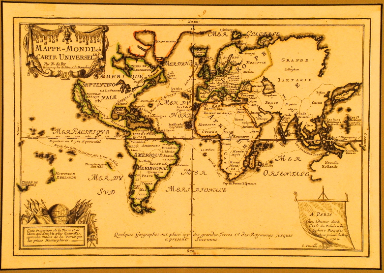
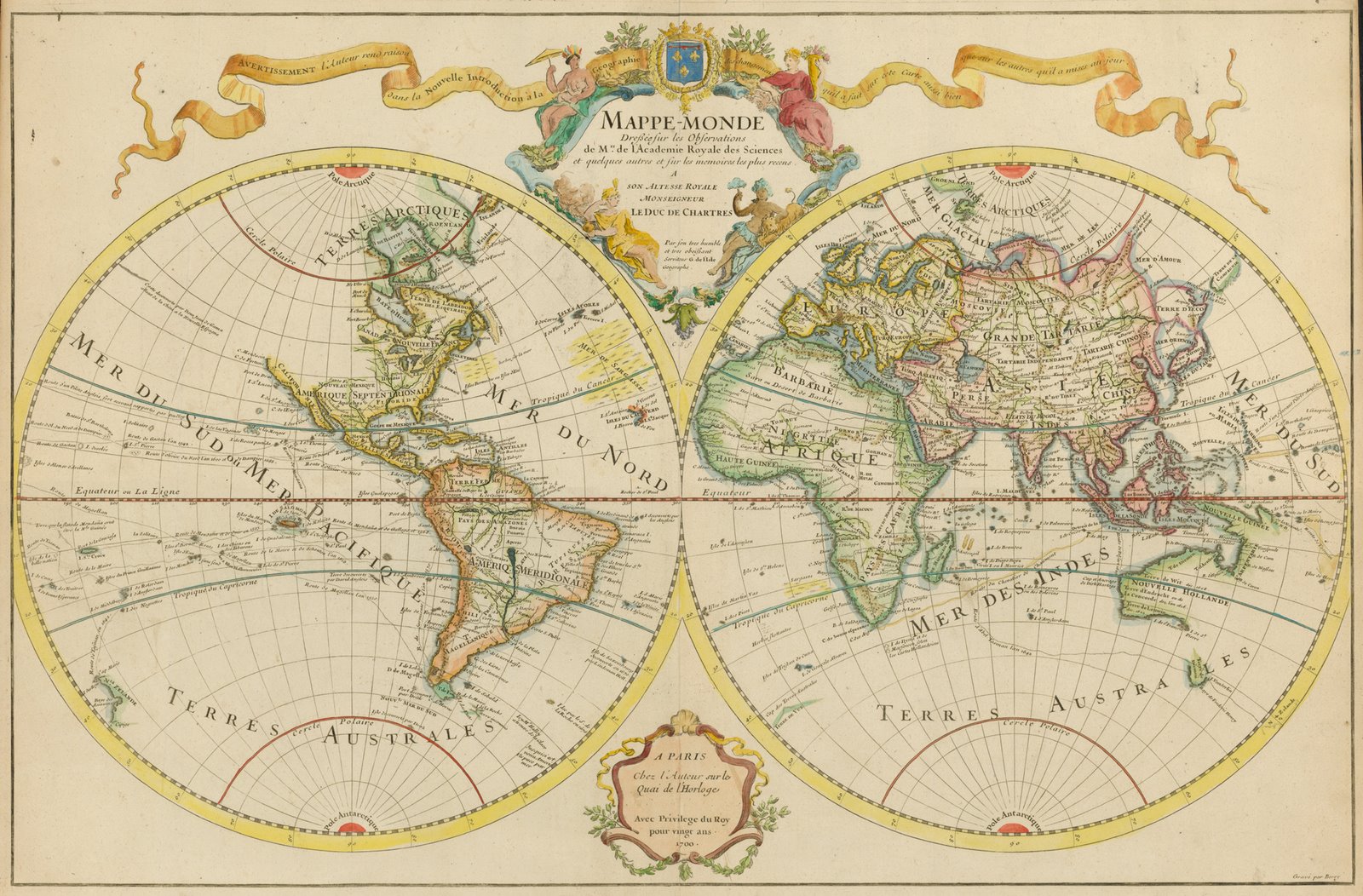
The 15th century sparked a revival of Ptolemy’s work, largely thanks to printed editions that spread across Europe. Cartographers like Martin Waldseemüller began to incorporate latitude and longitude more faithfully, producing world maps that hinted at the true shape of continents.
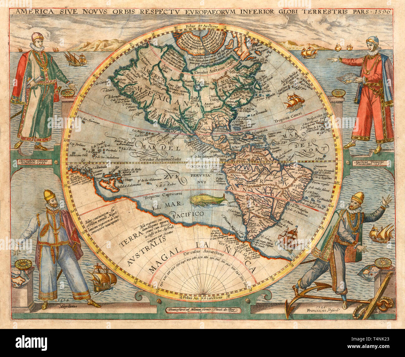
Simultaneously, the Age of Exploration forced map‑makers to confront reality. When Columbus reached the Caribbean in 1492, his reports challenged the long‑held belief that Asia lay just west of Europe. Portuguese explorers charted Africa’s coastline down to the Cape of Good Hope, while Spanish galleons mapped the Pacific’s vastness after Magellan’s circumnavigation.
Landmarks of the Era
- Waldseemüller’s 1507 map: First to label the new continent “America.”
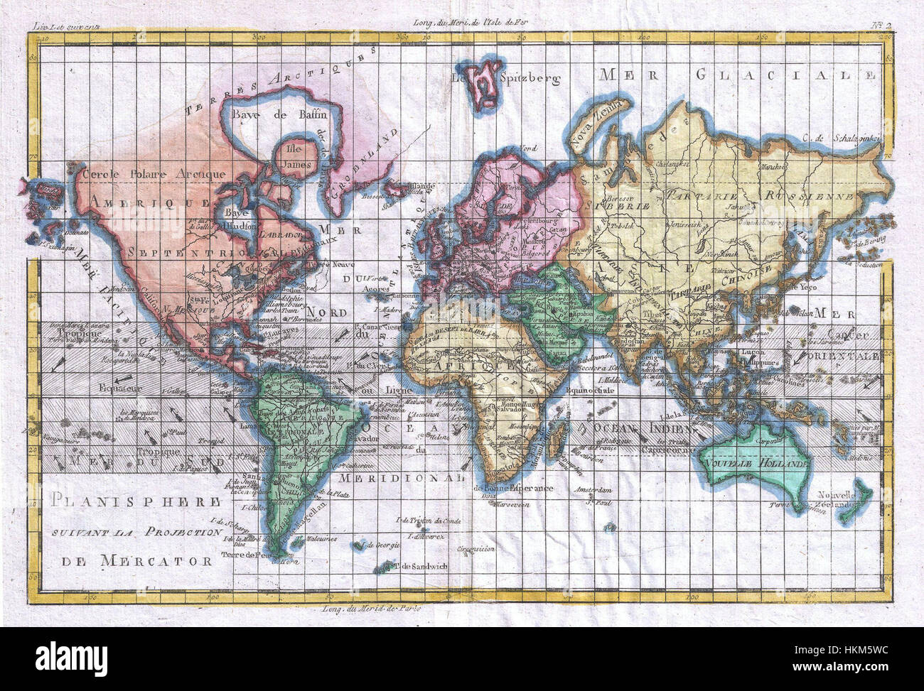
- Mercator’s projection (1569): Introduced a way to plot straight sailing courses, crucial for sea trade.
- Voyage reports: Turned mythic sea monsters into documented marine life and new islands.
These advances didn’t instantly produce perfect maps, but they marked a decisive shift from mythic representation toward empirical observation.
Printing, Projection, and the Road to Modernity
Johannes Gutenberg’s press in the mid‑15th century transformed map distribution. Once a costly, hand‑drawn artifact, a map could now be reproduced for scholars, merchants, and curious laypeople alike. This democratization spurred competition: cartographers raced to update coastlines, add newly discovered lands, and refine projections.
Projection techniques, especially the Mercator projection, solved a practical dilemma—how to translate a spherical Earth onto a flat surface without distorting navigation routes. While Mercator’s method exaggerated the size of high‑latitude lands, it became the standard for nautical charts well into the modern era.
By the early 1700s, map‑making had matured into a blend of art, science, and commerce. Atlases such as John Ogilby’s “Britannia” (1675) offered road maps for the first time, while Samuel Lewis’s later compilations would set the stage for contemporary geographic reference works.
Why Early Maps Still Matter
Looking back at maps created before the 18th century reminds us that geography is as much a cultural narrative as a physical description. Each illustration reveals the hopes, fears, and knowledge of its creators. Modern cartographers still grapple with similar challenges—balancing accuracy with readability, and acknowledging the biases that shape representation.
In museums and online archives, these ancient charts invite us to question how we perceive space today. They serve as visual time capsules, capturing moments when the world was both larger and smaller than we now understand.
Frequently Asked Questions
What was the significance of the portolan chart?
Portolan charts provided sailors with detailed coastline outlines, compass roses, and rhumb lines, making them indispensable for Mediterranean navigation long before the rise of scientific cartography.
How did the Mercator projection influence map making?
Introduced in 1569, the Mercator projection allowed straight-line courses to be plotted as constant compass bearings, revolutionizing sea travel despite its distortion of polar regions.
Why did medieval maps often include mythical creatures?
Cartographers filled unknown spaces with legends, sea monsters, and imagined lands to convey both the limits of contemporary knowledge and the cultural stories that travelers brought back.
Did early maps accurately depict continents?
Accuracy varied widely; while some coastal outlines were surprisingly precise, interior regions often remained speculative until later explorations corrected earlier misconceptions.